Vacated

“Vacated” was the unofficial precursor to Google Street View’s Time Machine feature. The project reverse engineered Google Street View to find historic images hidden in plain sight. Eight months after Vacated was released and received widespread media attention, Google publicly released certain historic street view imagery through Time Machine.
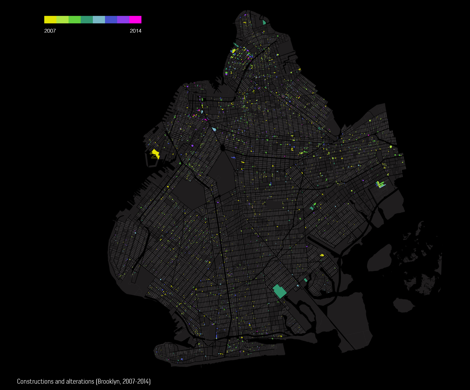
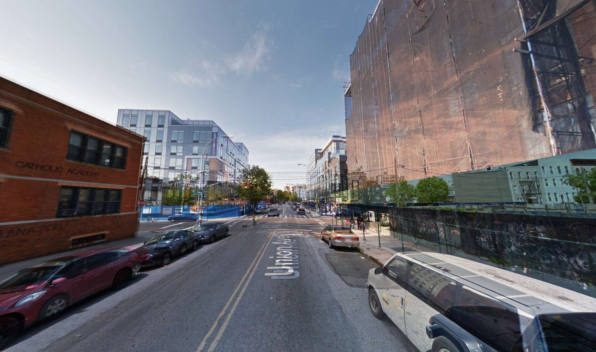
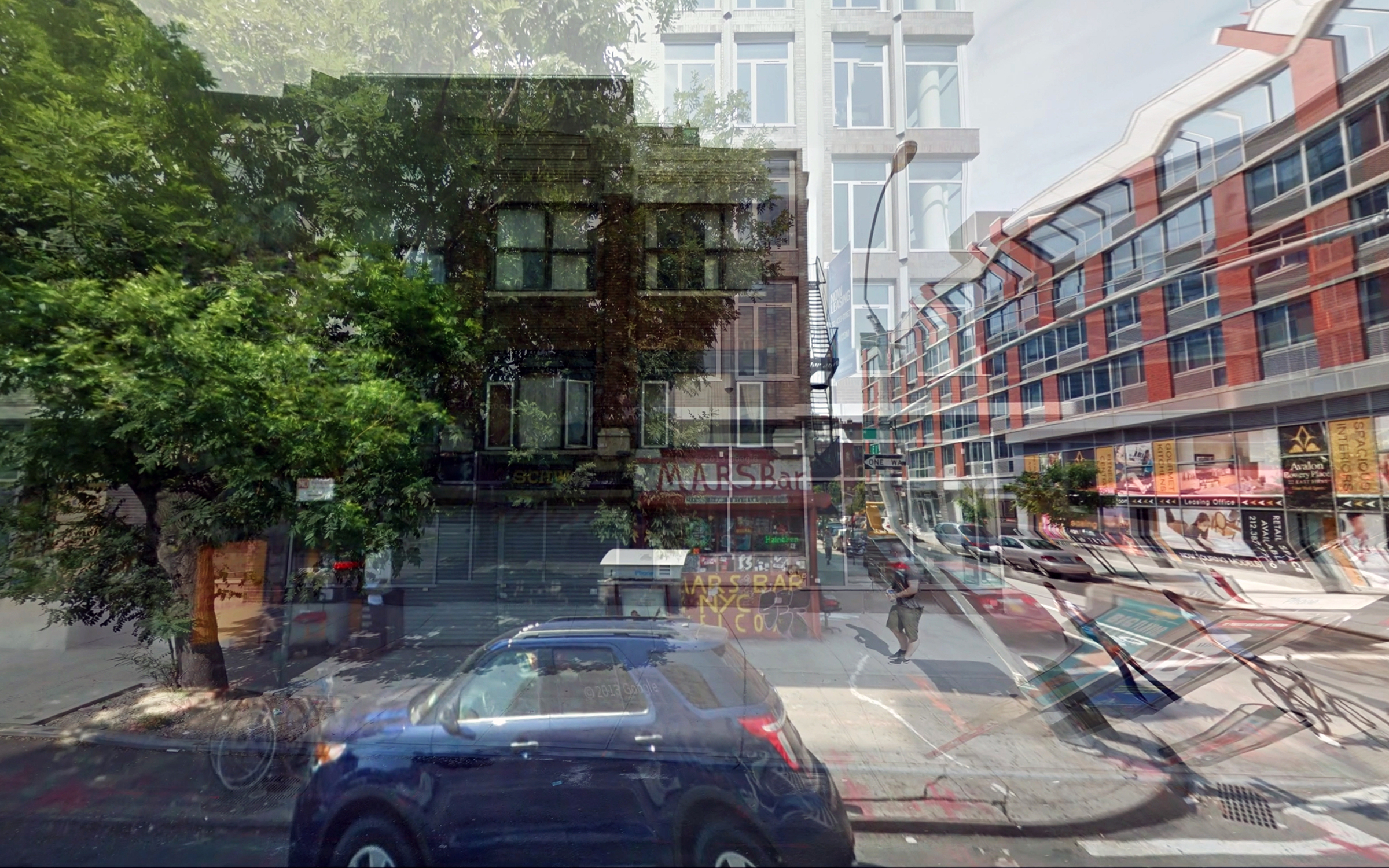
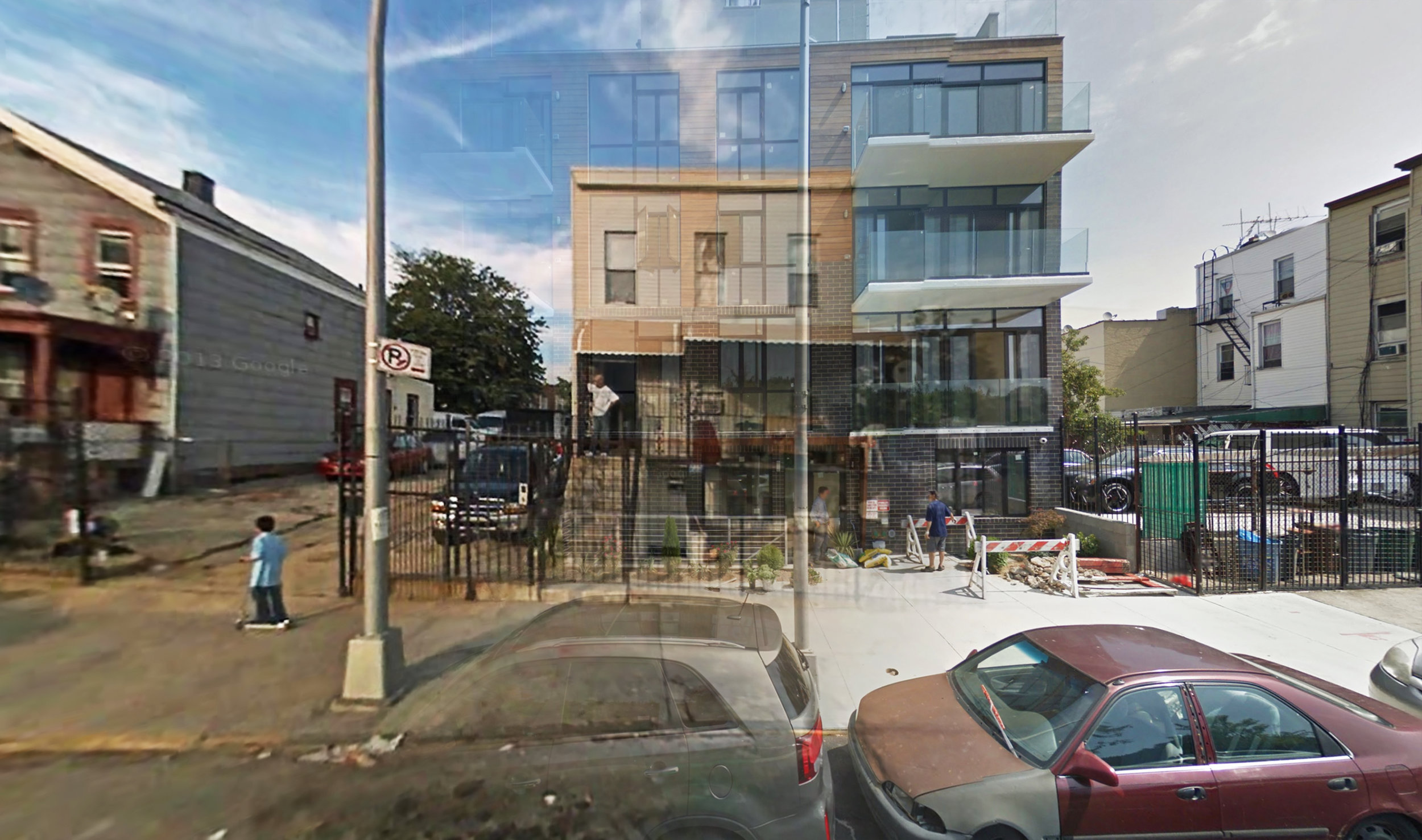
These images are algorithmically extracted by merging the Department of City Planning's PLUTO dataset with Google Street View, and searching for all properties that have been altered or constructed since Google Street View began (2007.)
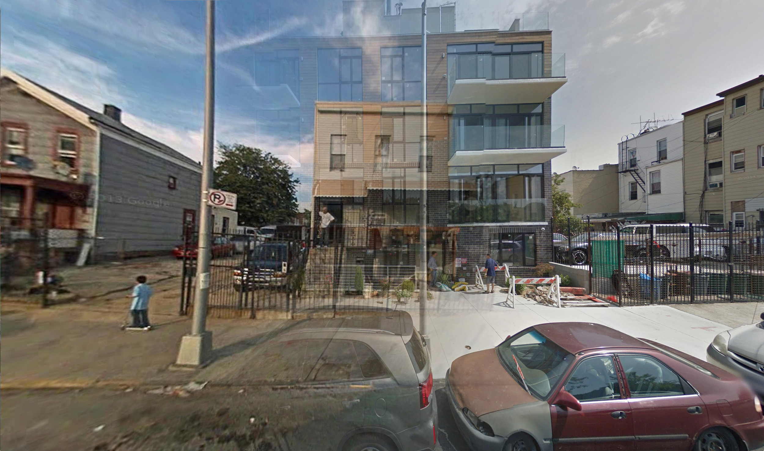
The project mines and combines different datasets on vacant lots to present a sort of physical façade of gentrification, one that immediately prompts questions by virtue of its incompleteness: “Vacated by whom? Why? How long had they been there? And who’s replacing them?” Are all these changes instances of gentrification, or just some? While we usually think of gentrification in terms of what is new or has been displaced, the project highlights the momentary absence of such buildings, either because they’ve been demolished or have not yet been built. All images depicted in the project are both temporal and ephemeral, since they draw upon image caches that will eventually be replaced.
Ultimately, “Vacated” presents a walking tour of the changing urban landscape during the Bloomberg administration— it depicts some obvious examples of dramatic change, but in the end, it's up to the viewer to decide whether this change represents widespread gentrification.
Process
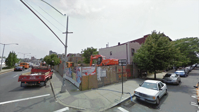
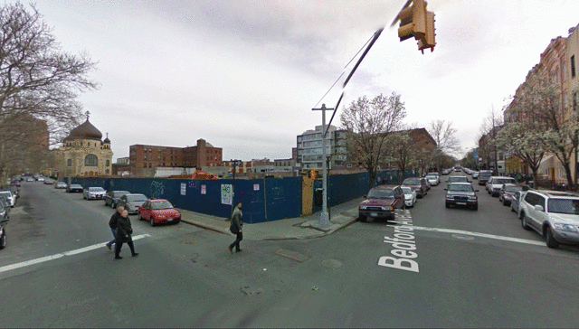
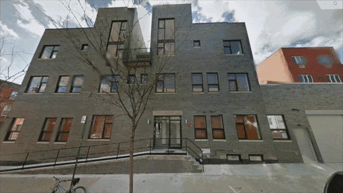
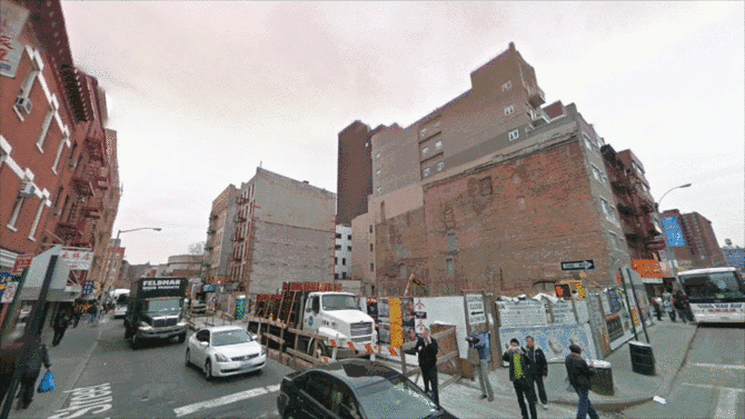
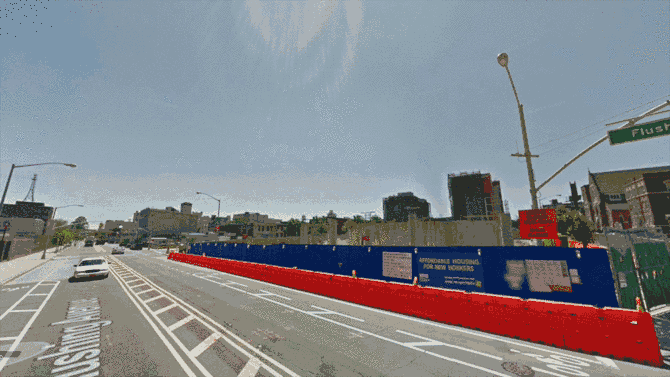
This project began by examining whether temporal differences in Google Street View's cache could be used as a device to narrate rapidly changing urban landscapes. Since Google updates major roads on Street View more frequently, buildings located along intersections often contain images from two different time periods. This temporal gap can be large enough to span the entire construction of a new building.
To find these some of these gaps, I used the NYC Department of City Planning PLUTO dataset to extract addresses that had been built or altered since 2007. I then scraped Google Street View images for these locations to find cached, historical images.
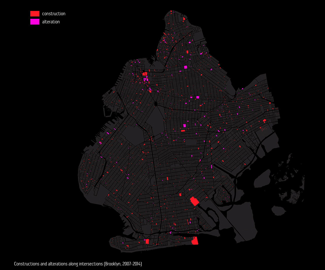
During my research, I found that Google Street View cars often capture intersecting streets at different time periods. These time differences range from a few months to more than a year. If you visit these intersections in Google Street View and cross the intersection, the time period will change, revealing before and after imagery for the block. The PLUTO dataset contains a "Lot Type" field for each entry, which I used to find only properties that are located on intersections and were built or altered since 2007. Using this filtered dataset, I created a new script that scraped imagery for 2 different positions at each intersection, capturing before and after images for blocks en masse.
Hacking Google Street View
Google's CEO, Eric Schmidt, has repeatedly stated Street View only ever photographs a location once, as a privacy measure. Those who desire greater privacy measures "can just move".
In April 2014 Google released a large portion of historical Street View image data through a tool called "Time Machine" tool. This historical imagery had previously remained unavailable to (or hidden from) the public for over seven years.
The imagery collected for “Vacated” was only accessible by data mining and cross-referencing the Google Street View and New York City's PLUTO datasets to find cached imagery along street intersections, where two separate cars had converged at different time periods. The new Time Machine tool allows all of us to more easily reflect upon historical images of any building or lot, on intersections or not.
Year: 2013
Exhibitions:
Design & Violence, MoMA
Mapping Brooklyn, BRIC Arts Media House
Envision NY 2017, More Art
Q&A with More Art about Vacated commission.
Selected Press:
The Washington Post
Bloomberg
Fast Company
The Verge
Business Insider
Salon
Gothamist
Gizmodo
Flowing Data
New York Magazine
Animal
Complex
Curbed
Laughing Squid
Design Taxi
Publications:
“Hardcore Architecture: Justin Blinder” Michelle Millar Fisher. Hardcore Architecture Series
“The Street as a Database” Justin Blinder. Cleveland Urban Design Collaborative.
“Absence in Context: Recontextualizing civic data, critical, cartographies, and gentrification in New York City” Justin Blinder. Ubiquity: The Journal of Pervasive Media.